
Wild City Mapping immerses visitors in the story of urban nature in Montreal and its relationship to residents.
After nearly ten years of work, the Wild City Mapping Collective, a group of visual and media artists, mapping enthusiasts, wilderness lovers and tech geeks, can see their work come to fruition.
Their goal: to demonstrate the personal significance of wild urban spaces.
“We map the wild green space in Montreal but through the eyes of the people that see them,” Maia Iotzova explained. “So we want to see the personal significance that these spaces have.”

Iotzova is a filmmaker, media artist and founder of the collective. Originally from Sofia, Bulgaria, she immigrated to Canada in 1996 and earned a BA in Fine Arts at the University of Guelph. Iotzova has always had a strong connection to urban nature which she attributes to the many green spaces in Bulgaria.
In 2004 she directed Grass Through Concrete, a film about preserving one of Canada’s largest urban parks. Later, in 2014 she formed The Wild City Mapping Collective as a way to compile a creative open-source map of the wild green spaces in Montreal.
Art Through Cartography
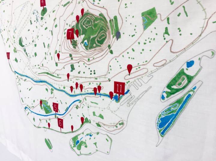
Working with fellow members Marilène Gaudet and Dominique Ferraton, the collective uses geographical maps, photos and printed textiles, as well as video and sound components. They also asked people to share pictures and texts of their favourite green spaces in the city.
Now, on the second floor of the Maison de la culture de Côte-des-Neiges, these often ignored or misunderstood green spaces, are seen for their invaluable cultural, social and ecological role in the city.
“Cartography is such a beautiful form of art, she said. ‘“Every map is a piece of artwork in a way. They are anything but technical. They become shorthand for what something means to us.”
Iotzova explained that mapping is powerful. The way an area is mapped can change someone’s perspective of the city. An image of the city of Montreal, for example, is mapped using only natural features. Streets and buildings are replaced with greenspaces, waterways and topographic lines.
Meanwhile, another map made by Ferraton, is sure to include a small drawing of a cat.
“We are putting emotions and lived experiences into these spaces that, on a map, would be grey spaces”, said Iotzova. “What we are reimaging is that this is a very alive space. What does this mean to people? and how do they see it? We’re putting that information on the map.”
Working with the Community
The collective’s project has relied heavily on community involvement. Residents were asked to submit photos and writing to improve the cartographic portrait of Montreal.
Throughout the years, Wild City Mapping has also held smaller events including an art exhibition and city walks. With every new event, Iotzova explained that they meet new people, and their collection grows.
“It’s a durational project,” she said. “The spaces develop. Some have developed into protective parks and others into condos and we follow these spaces.”

While the exposition will come to end in September, the collective continues to ask for submissions of images and thoughts on Montreal’s urban green spaces.
“It shows the connection that people have to these spaces and that they really mean something to the community,” she said. “When something means something to the community we think more about protecting it. In urban spaces, these are like a little escape of nature and people love that.”
Wild City Mapping will be on display until September 10th.
